Walks & Routes Nearby
We have listed below some of the local walks, footpaths and routes to get you out and about into the fabulous Leicestershire Countryside. From a short meander via pavements and lanes to the next village, or a day walking the longer routes, there is so much to see in our beautiful location.
The Battlefields & Borderlands Way book is in the accommodation (bedside drawer) and shows a wonderful (but very long) circular walk from which shorter sections can be explored by the avid walker.
Bear with us as we create and upload some maps to help you get about..
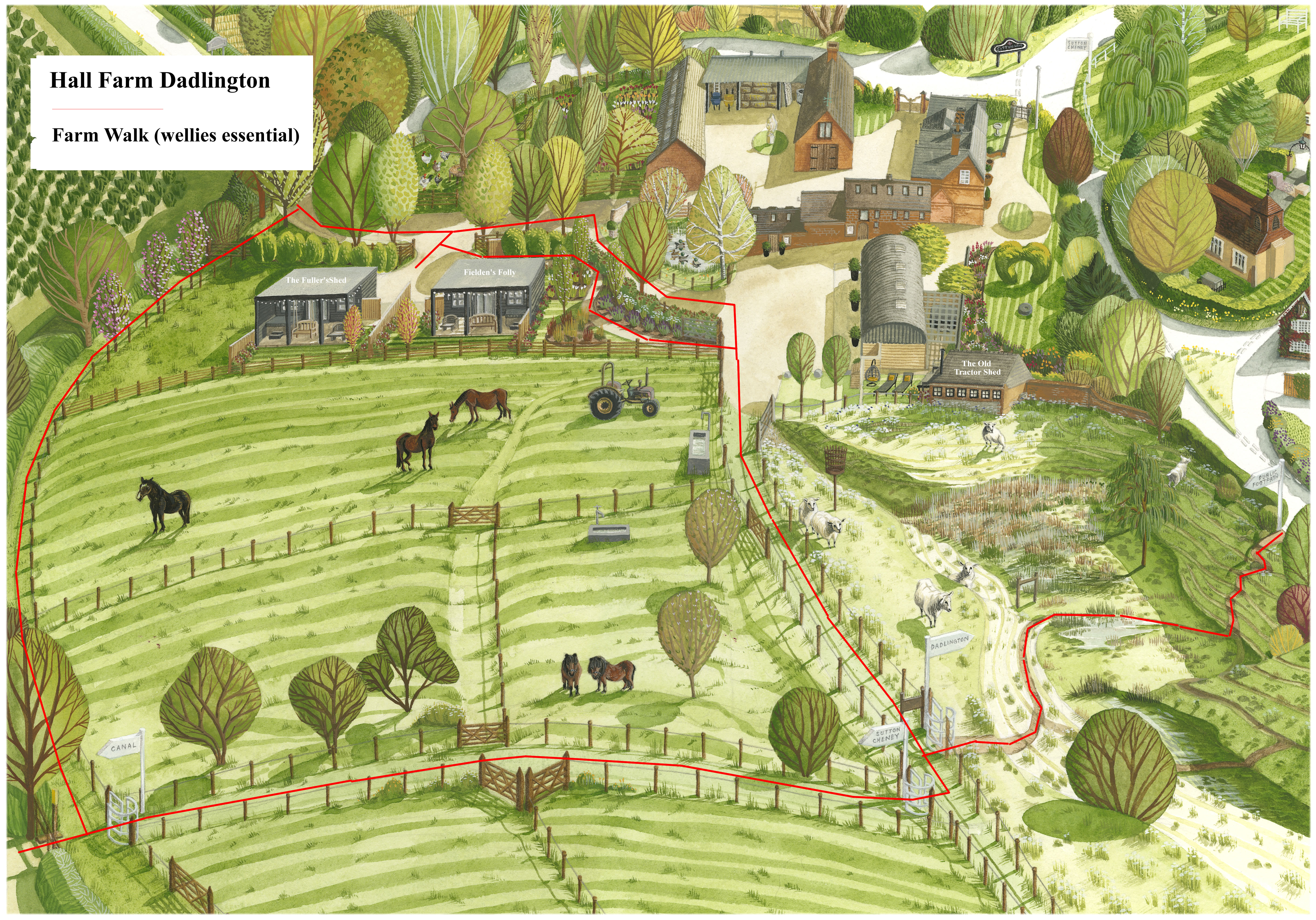
- Short walk around our farm track (can be very muddy)
- Walk to Stoke Golding (daylight hours) – an easy walk via road and lane with three pubs – 40 mins circular. We recommend using Stoke Lane during daylight and using the pavement via Hinckley Road after dusk or take our torches from the bedside drawer and kitchen cupboard.
- Walk to Stoke Golding via the canal towpath
- Four ways to get to the canal towpath…
- Left out of our driveway down Sutton Lane to the canal bridge take the steps down under the bridge
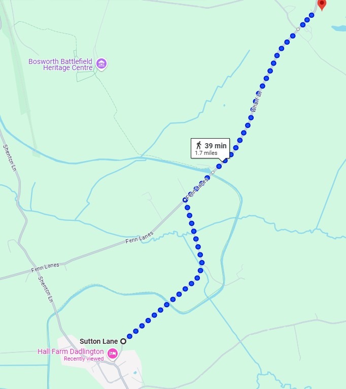
- Right out of our driveway, up to the T junction in the village, right down Shenton Lane out of the village to the canal bridge, take the steps down under the bridge
- From our parking yard, head up the grass track between our fields along the pit top to the set of kissing gates, turn right through the kissing gate and take the track between the fields to the next kissing gate and stile heading down to the canal bridge.
- Head to the entrance to our driveway and take the gate into the field track (can be exceptionally wet). Take the first stile right into the neoighbouring field down to the canal bridge.
- Walk Dadlington to Sutton Cheney via road – lane then 50mph road with grass verge
- Dadlington & Ashby Canal Walk – A 4.8km circular walk featuring the Ashby Canal at Dadlington – Inland Waterways Map and Route
- Walk to Sutton Cheney Wharf & Cafe via the canal towpath
- Walk-26-Sutton-Cheney-Wharf-to-Bosworth-Battlefield-Centre
- Walk-27-Sutton-Cheney-to-Market-Bosworth-Country-Park
- Explore Bosworth – Map of the local area
- The Leicestershire Round – a circular walk can be broken down into shorter walks
- Ashby Canal Association – Guide to the Ashby Canal
- Walk to Shenton – map pending
- Walk to Shenton Station – map pending
- Footpath from Dadlington via Stapleton Lane back to Sutton Lane and our driveway – map pending
- Footpath from Dadlington via Goslings farm to Stapleton Lane back to Sutton Lane – map pending